


Written by Veronica |
Among all the major rivers in the world, the Yellow River (Huanghe River), which has a history of 3,000 years, is unique. Today, let’s learn about the geography, history, cultural impact, modern challenges, and key attractions of the Yellow River together.
The Yellow River is the second longest/largest river in China (after the Yangtze River). From a bird’s-eye view, the Yellow River is in a large “几” shape, flowing eastward into the Bohai Sea. With relentless force, it has carved deep canyons, wide plains, and majestic waterfalls, creating breathtaking natural landscapes.
The Yellow River is the most important source of Chinese civilization, nurturing generations of Chinese people and serving as the “Mother River” of the Chinese nation. The Yellow River Basin is the earliest developed region in China. When most parts of the world were still in a state of ignorance, Chinese ancestors have worked hard on this vast land and created a brilliant ancient culture.
Content Preview
- What Is the Yellow River
- Yellow River Geography
- Yellow River’s Course
- Why Is the Yellow River Called China’s Mother River?
- Exploring the Yellow River: Key Attractions and Experiences
- Merits & Demerits, Governance of the Yellow River
- Tour Main Cities Along the Yellow River With Us
What Is the Yellow River
The Yellow River was formerly known as “the River” or “Great River”. In Ban Gu’s book during the Eastern Han Dynasty, the term “Yellow River” first appeared to describe its turbidity.
Basic Facts About the Yellow River
- Chinese Name: 黄河
- Nickname: “Mother River”
- Location: Northern China
- Length and Area: approximately 5,464 kilometers long, with a basin area of 752,443 square kilometers and a total drop of 4,480 meters
- Riverhead: the northern foothills of the Bayan Har Mountains on the Qinghai–Tibet Plateau
- Regions it flows through: Qinghai, Sichuan, Gansu, Ningxia, Inner Mongolia, Shaanxi, Shanxi, Henan and Shandong, totaling 9 provinces/autonomous regions
- Main Tributaries: Wei River, Tao River, Huangshui River, Fen River, Luo River, Wuding River, etc.
- Hydrological Characteristics: long winters and short summers, and distinct seasonal temperature changes; a small amount of precipitation, mainly featuring dryland agriculture, and precipitation concentrates in the summer and autumn months (July and August)

Why Is It Yellow?
One fact about the Yellow River is that “yellow” is actually sediment. There is a record in ancient books that “A bucket of Yellow River water contains seven-tenths mud”. Due to middle section flowing through the Loess Plateau, the River carries a large amount of sediment, making it the world’s muddiest river. The Yellow River carries 1.6 billion tons of sediment every year, of which 1.2 billion tons flow into the sea, and the rest 400 million tons remain in the lower reaches, forming a river plain that is conducive to planting.
Where is the Yellow River
With a length of about 5,500 kilometers, the Yellow River stretches over 9 provinces and autonomous regions in northern China, including Qinghai, Sichuan, Gansu, Ningxia, Inner Mongolia, Shaanxi, Shanxi, Henan and Shandong.
Yellow River Geography
First to know: where does the Yellow River start and end? The Yellow River starts from Yaguzonglie Basin in Maduo County, Qinghai Province and flows intoBohai Sea at Kenli District, Dongying City, shandong Province.
The Upper Reaches of the Yellow River
The upper reaches of Yellow River start from source region and end at Hekou Town in Inner Mongolia. Its total length is over 3,400 kilometers and its area accounts for over 50% of the river. The upper reaches can also be divided into three sections: source region section, valley section and alluvial plain section.
The first section is in high plateau area and there are more lakes, marshes and meadows on both banks. And the water is relatively clear. The second section is interwoven with rivers and gorges. Over 20 gorges can be found here. While the last section has a flat terrain, both the Yinchuan Plain and Hetao Plain are located here.
The Middle Reaches of the Yellow River
The middle reaches are from Hekou Town to Peach Blossom Valley in Zhengzhou, Henan Province. It is the main source area of sediment of Yellow River, which results in about 90% of the total sand content of the river. The length is about 1,200 kilometers and the area accounts for about 45% of Yellow River.
The middle reaches also consists of three sections. The first section is the continuous valley in Shaanxi and Shanxi provinces. Coarse silt and sand of Yellow River are mainly sourced from here. The famous Hukou Waterfall is located there. The second section is a plain section, where two main branches converge, Fen River and Wei River. The third section transits from mountainous areas into plains.
The Lower Reaches of the Yellow River
The lower reaches are 786 kilometers long, and the area accounts for only 3% of the entire river. Most areas are plains. So after years of the massive accumulation of sand and silt, the riverbed rises above the ground on both banks, forming the world-famous “suspended river above ground”. And there are almost no large branches in the lower reaches. Since ancient China, how to prevent or control the flood here has been an important problem.
Related reading: Yangtze River vs Yellow River
Yellow River’s Course
Journey From Source to Sea
The Yellow River rushes thousands of miles from the Bayan Har Mountains to the vast ocean (Bohai Sea). The area west of Duoshixia in Maduo County, Qinghai Province – Yaguzonglie Basin is the source of the Yellow River.
It’s also known as the “Nine-Bend Yellow River”. According to the geographical, geological, and hydrological conditions that contribute to the formation and development of the Yellow River Valley, the main stream of the Yellow River can be divided into three sections:
- The river from source to Hekou Town in Togtoh County, Inner Mongolia is the upstream, with a length of 3471.6 kilometers. The upstream water source mainly comes from the melted ice and snow from high mountains, and the sediment content of rivers is relatively low.
- The middle reaches of the Yellow River are from Hekou Town to Taohuayu in Zhengzhou City, Henan Province. This river section is 1206.4 kilometers long. Its main source comes from rainwater supply, and summer is the flood season.
- The River from Taohuayu to the estuary in Dongying, Shandong is downstream. This basin area accounts for only 3% of the total. The downstream river runs through the North China Plain, with slow water flow, forming an “above-ground river”, and is mainly constrained by embankments.
East of Lijin County is the estuary section of the Yellow River. The estuary is located between Bohai Bay and Laizhou Bay, and is a weakly tidal, sandy, and frequently oscillating. Because the Yellow River carries a large amount of sediment to the estuary area, most of it accumulates in the coastal region, forming the Yellow River Delta.
Geographical Origins and Course Changes
The birth and development of the Yellow River are constrained by geological processes, with tectonic movements generated by crustal changes as external forces, and erosion, transport, and accumulation generated by hydrogeological conditions as internal forces.
According to research, the Yellow River channel was initially formed by large, unconnected lakes, and gradually evolved into a great river that flows into the ocean under the influence of China’s high west and low east terrain, river erosion, and climate. The soil erosion on the Loess Plateau and the sediment accumulation in the lower reaches of the Yellow River have been occurring since prehistoric geological periods, and have been increasingly influenced by human activities.
The changes in the course of the Yellow River mainly occur downstream, roughly ranging from the Haihe River in the north to the Jianghuai Rivers in the south. According to historical records, there have been over 1,500 breaches and floods, and over 20 major course changes in the lower reaches of the Yellow River. This is why China’s Yellow River also called “China’s sorrow.”
So, is the Yellow River still prone to major floods? Yes, especially in the lower and middle reaches, there is still a high risk of flood.

Popular China Yellow River Tours
- 4 Days Classic Xining Tour with Qinghai Lake and Chaka Lake
- 4 Days Hohhot and Xilamuren Grassland Tour
- 6 Days Classic Xi’an and Luoyang Tour
Why Is the Yellow River Called China’s Mother River?
The Yellow River has profound influence on Chinese civilization, history, culture, and national spirit:
The Birthplace of Chinese Nation
As early as ancient times, primitive ancestors in China, such as the Lantian people, lived in the Yellow River Valley. In the Neolithic Age, the Yellow River Basin saw the emergence of Yangshao, Longshan, and other cultures, proving that here is one of the earliest origins of Chinese civilization.
The Cradle of Agricultural Civilization
The fertile soil in the Yellow River basin provided ideal conditions for early agriculture. Thousands of years ago, Chinese people planted millet, wheat and other crops here, laying the foundation of agricultural civilization.
China’s Political and Economic Center
The legendary “Yu the Great Harnesses the Flood” occurred in the Yellow River Basin. From Xia, Shang, and Zhou, to Han, Tang and Northern Song, many dynasties established their capitals in the Yellow River Basin. Until the Song Dynasty, the Yellow River Basin had been the most economically developed region in China.
Brilliant Cultural Heritage
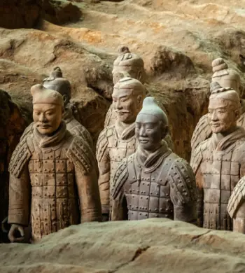
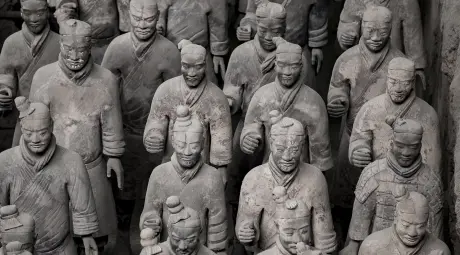
Yellow River Basin has nurtured rich cultural heritage, including classic works such as “the Book of Songs” and “the Analects”, as well as numerous art forms such as poetry and music. There are also many historical sites, such as the Great Wall, the Terra Cotta Army, the Longmen Grottoes, which are treasures of Chinese history.
A Symbol of Chinese Nation’s Spirit
The Yellow River, with its majestic momentum and ceaseless flowing water, symbolizes the indomitable and courageous spirit of the Chinese nation. The Yellow River frequently changed its course and flooded, forcing ancient people to constantly manage the River and strengthen national cohesion.
Exploring the Yellow River: Key Attractions and Experiences
The natural and cultural landscapes along the Yellow River are extremely rich. Here are a few of the most classic scenic areas:
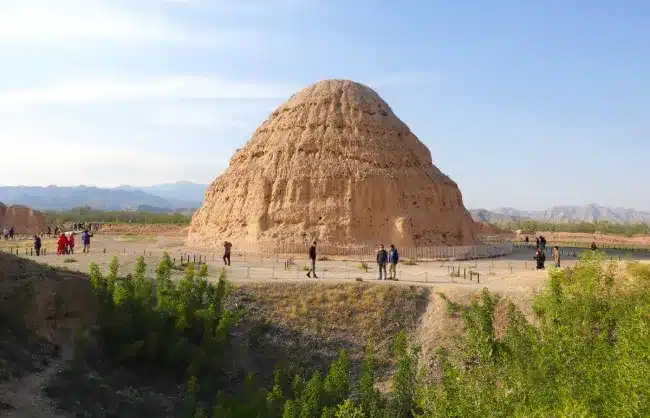
Sanjiangyuan Natural Reserve
Located in the hinterland of Qinghai, it boasts magnificent scenery of the plateau. Among them, the Yellow River Source National Park is mainly divided into three parts – Donggecuona Lake (for viewing wild animals), Two Lakes and One Monument (referring to Eling Lake, Zhaling Lake and Yak Head Monument), and Huanghe Town (wetland desert).
Huanghe River Custom Tourist Line of Lanzhou
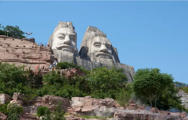
Lanzhou is a provincial capital where the Yellow River runs through. The over-100-li-long riverside road, with the Yellow River Iron Bridge (Zhongshan Bridge) as the center, is known as the “Lanzhou Bund”. Famous attractions: the Yellow River Mother Statue, Baita Mountain Park. From Lanzhou, you can embark on a wonderful China Silk Road Tour.

Shapotou in Zhongwei, Ningxia
Shapotou Tourist Area is located on the southeastern edge of the Tengger Desert, integrating deserts, the Yellow River, mountains, and oases. It creates a unique and magnificent landscape of “long river sunset, desert starry sky”, and offers unique activities such as sheepskin raft drifting and sand sliding.
Laoniuwan in Inner Mongolia
Located in Qingshuihe County, Hohhot City, Laoniuwan is the only place where the Yellow River and the Great Wall intersect, and one of the “Top Ten Most Beautiful Canyons in China”. It has well preserved ancient villages, and the scenery is magnificent at dusk.

Hukou Waterfall
Located in the Jin-shan Grand Canyon, it is the only waterfall on the main stream of the Yellow River and the second largest waterfall in China. Hukou Waterfall integrates the Yellow River Gorge, Loess Plateau, and ancient villages, and is very magnificent when the water is abundant in summer.
Longmen Grottoes
Located on both sides of the Yi River in Luoyang, Longmen Grottoes is the first of the four major grottoes in China and a world cultural heritage site. Its excavation began in the Northern Wei Dynasty (493 AD) and lasted for more than 400 years. There are about 100,000 Buddha statues in total, especially the famous Vairocana Buddha.
Can you cruise or travel along the Yellow River?
Yes, you can explore the Yellow River by cruise ship. But it does not cover the whole river, only in some scenic areas and cities can you experience it, such as Lanzhou, Hukou Waterfall, Yellow River Grand Canyon in Ningxia, and the Yellow River estuary in Shandong. And to travel along the river, self-driving and chartered buses are the most common ways.
Merits & Demerits, Governance of the Yellow River
Main Uses Today
As the most important river in northern China, the Yellow River is now mainly used for water supply, power generation, irrigation, tourism, shipping, ecological regulation, etc.
- It provides abundant production and domestic water for regions along the Yellow River, and is an important source of agricultural irrigation, industrial production, and residential water.
- The Yellow River has abundant hydraulic resources, and by constructing hydropower stations, it can generate electricity and provide power supply to surrounding areas.
- With a profound cultural heritage and natural landscape value, scenic spots such as Hukou Waterfall along the River attract a large number of tourists.
- The shipping value of the Yellow River is relatively low, and only some sections have certain navigation capacity during non-icing and flood seasons.
- Wetland restoration and soil and water conservation in the Yellow River Basin are of great significance for protecting the ecosystem.
Related reading: Yellow River Civilization
Challenges – Flooding
Floods in the upper reaches of the Yellow River mostly occur in September, mainly from west of Lanzhou. The upstream is mostly mountainous canyon sections, and the flood propagation time generally does not change much.
61% of the area in the middle reaches of the Yellow River is the Loess Plateau, so floods are generally concentrated from mid-July to mid-August, especially in early August.
In addition, many sections of the Yellow River are frozen and blocked in winter. Every early spring, ice floods often occur in two river sections: from Shizuishan in Ningxia to Hekou Town in Inner Mongolia, and from Huayuankou to the estuary.
What are the other main environmental challenges facing the Yellow River today?
- Water shortage:There is a large number of population, land and cities along Yellow River, but its total water resource is limited, so the water is generally in short of supply.
- Soil and water loss: The middle reaches flow through the loess plateau. The soil and water loss in this section has been serious for a long time.
- Water pollution: Along the river, plenty of industrial, agricultural and domestic sewage are discharged.
- Fragile ecological environment: The upper, middle and lower reaches all face different pressure in ecological protection.
- Suspended river above ground: one of the greatest threats to the river.
Conservation and Harnessing
Yellow River governance is a difficult and complex undertaking. It is a frontline battle to prevent desertification from expanding southeastward, a major measure to control soil erosion in the Loess Plateau, and a fundamental way to eliminate downstream floods and ensure the North China Plain’s development.
At present, China has established many water-control projects such as Sanmenxia and Xiaolangdi, as well as irrigation projects and water and sediment regulation in the Yellow River, which have enabled the main stream of the Yellow River to achieve continuous flow for 25 years.
If you like, read on 20 interesting facts about the Yangtze River – another important cradle of Chinese civilization.
What’s the difference between the Yellow River and Yangtze River?
Features |
Yellow River |
Yangtze River |
Length |
About 5,464 km (2nd longest river in China) |
Over 6,300 km (Longest river in China) |
Source |
Bayan Har Mountains, Qinghai |
Geladandong Peak, Tanggula Mountains, Qinghai |
Flows into |
Bohai Sea |
East China Sea |
Basin area |
About 750,000 sq.km. |
About 1,800,000 sq.km. |
Annual Runoff |
About 58 billion m³ (2% of national river runoff) |
About 975.5 billion m³ (over 1/3 of national river runoff) |
Number of Provinces Traversed |
9 |
11 |
Shape of River |
In the shape of Chinese character “几” |
“VW” shape |
Sediment Content |
Very high (world-famous sediment-laden river) |
Relatively low |
Hydrological Features |
Low water, high sediment, has ice period, shorter flood period, lower reaches form an “elevated river” |
Abundant water, low sediment, no ice period, longer flood period |
Economic & Cultural Role |
Cradle of Chinese civilization, “Mother River” |
Major economic artery, “Golden Waterway”, developed for navigation |
Tour Main Cities Along the Yellow River With China Xian Tour
Follow us to explore the magnificent natural scenery and splendid cultural relics along the Yellow River in China. Travel to major cities, from Xining, Lanzhou, Yinchuan, and Ordos in the Northwest to ancient capitals such as Xi’an, Luoyang, Zhengzhou, and Kaifeng in the Central Plains, and experience the unique charm of ancient China civilization! China Xian Tour is experienced in planning city tours according to the travelers’ needs. Also, we can recommend the popular scenic spots based on your likes. To ensure you have an in-depth China tour, we will assign a knowledgeable guide for you. We are always glad to offer help, so feel free to contact us at any time.