


Written by Ivy Dong |
The size of the Taklamakan Desert is 330,000 square kilometers, which is 20% of Xinjiang’s land area and is equal to the total area of 50 cities as big as Shanghai. It is 1,000 kilometers from east to west and 400 kilometers from north to south. Inside, pyramid-shaped sand dunes stand as tall as 300 meters, and wailing winds can push these walls of sand even farther.
The dunes are relentless, forever advancing with the wind. The world’s tenth largest desert and the world’s second largest moving dune desert after the Arabian Peninsula’s Rub’ al Khali, the Taklamakan Desert is simply nicknamed the “Sea of Death,” the world’s second-largest non-polar dune desert.
Its name, “Taklamakan,” is possibly from the Uyghur language, meaning “you can go in, but you can’t get out,” or some say it’s Turkish for “land of ruins.” It was in this inhospitable terrain that the karez irrigation system was created, a testament to humankind’s ingenuity for surviving such a brutal land.
Content Preview
- Facts About the Taklamakan Desert
- Where is the Taklamakan Desert
- History of Taklamakan Desert
- Physiography of Taklamakan Desert
- Taklamakan Desert Climate
- Weather and Best Time to Go
- Key Desert Highway Stops or Villages
- Plant and Animal of Taklamakan Desert
- Taklamakan Desert and the Silk Road
- What to See and Visit in Taklamakan Desert
- How to Get to Taklamakan Desert
- Wearing and Packing Tips
- FAQs about Taklamakan Desert
- Embark on a Xinjiang Adventure with China Xian Tour
Facts About the Taklamakan Desert
- Location: Southwest Xinjiang, Northwest China; Center of Tarim Basin.
- Area: 330,000 square kilometers.
- Type: Desert, Geologic Formations.
- Best Time: Late October to Mid-November.
- Suggested Visiting Duration: 1-2 days.
- Opening Time: Throughout the Day.
Where is the Taklamakan Desert
The Taklamakan Desert is located in the center of the Tarim Basin in Xinjiang, northwestern China. Visualize it extending from Korla in the east, where it borders the Gobi Desert, all the way to the west near Kashgar, just by the Pamir Plateau (not touching but close by).
Look at a Taklamakan Desert map, and you’ll see the southern portion hugged by the Kunlun Mountains, with the north stretching out to Aksu, facing the Tianshan Mountains. It’s a huge, breathtaking desert landscape, enclosed by nature’s own walls. And, of course, we’re talking about the Taklamakan Desert here, a place like no other.
√Related reading: Top 6 Deserts in China

History of Taklamakan Desert
The origin of the Taklamakan Desert’s name has been a subject of historical controversy. It wasn’t until recently that the Taklamakan Desert was officially given its vibrant name by the Uyghur people. “Takla” is a word in the Uyghur language that implies “beneath” or “place of beginning,” while “Makan” implies “dwelling” or “spot.” Together, they mean “the dwelling beneath the desert” or “place of beginning,” which describes the historical status of the Taklamakan Desert of China.
The origins of the Taklamakan Desert are directly linked to tectonic activity. It is a land created by the fierce collision of the South Asian subcontinent and the Eurasian Plate. The collision uplifted the Himalayas and the Tibetan Plateau and formed huge fold mountains like the Kunlun and Tianshan.
The basin is blanketed by a deep layer of continental sediments of over ten thousand meters in depth. These sediments, eroded by relentless winds, gather, move, and stack up to form boundless shifting dunes and, finally, the Taklamakan Desert. It is a land where the people of the Taklamakan Desert have lived and thrived amidst the sands.
Physiography of Taklamakan Desert
China’s Taklamakan Desert is a place of geomorphological surprises, with its magnificent mountain and dune landscapes predominant.
There are suddenly small hills and chain-like mountain ranges within the great desert, made up of Cenozoic sandstone and clay, among which the Mazartag Mountains and Rostag Mountains are most prominent. While the mountains are not high, they make the Taklamakan Desert rugged and stratified. Their surfaces are overlain by thin layers of weathered material and rock fragments, and scattered vegetation marks the general features of the desert.
Moreover, the Taklamakan Desert is famous for its wide, never-ending dunes. These dunes, formed from loose alluvial deposits by weathering, hold windblown sand layers as deep as one thousand feet. They come in all sizes and shapes, ranging from heights of a few dozen meters to over a hundred meters, and lengths from hundreds to thousands of meters.
These dunes are in a constant state of flux under the hand of the wind and create a dramatic aeolian landscape. For those who are asking the location of Taklamakan Desert, you can find it covering parts of China. These dunes not only add to the landscape of the Taklamakan Desert but also draw in tourists and adventurers from all over the world, making it a destination that needs to be visited.
Specific types of dunes
What are the types of these special dunes? There are four main types: transversal dunes, longitudinal dunes, starred dunes and dome-shaped dunes.
Transversal dunes are perpendicular to the prevailing wind direction. Crescent-shaped dunes and chains of dunes are common, with gentle windward slopes and steep leeward slopes. In the southeast of the desert, you will find longitudinal dunes, which are parallel to the prevailing wind direction or the resultant wind direction. The sand ridge is continuous and internal bedding slopes to both sides. The most spectacular are the starred dunes in the core area. Several sand ridges stretch from the top of the dune, forming a pyramid shape. Some dunes are up to 300 meters high. Dome-shaped dunes are approximately circular in shape or have a honeycomb-like pattern.
Taklamakan Desert Climate
The Taklamakan Desert is one where the climate is really different as it has an extreme continental climate. The annual precipitation is very little, from 38 millimeters in the west to as low as 10 millimeters in the east, while evaporation amounts to 2,500 to 3,400 millimeters a year, making the desert very dry. The summer temperature of the Taklamakan Desert hits a scorching 67.2℃, and the diurnal temperature range is more than 40℃, which is almost unbearable.
Yet winter brings its own issues, with January temperatures -9 to -10℃ and lows often below -20℃. Then there’s the sand and wind of the Taklamakan Desert, something else entirely, created by the combination of northerly and northwesterly winds.
Over 80% of the land is made up of mobile dunes. Spring is particularly susceptible to strong northeast winds, which can spark awful sandstorms, sending dust to heights of 3,962 meters and above.
And by the time summer comes, the western part of the Taklamakan Desert is mostly influenced by the northeast and northwesterly winds, developing a complex circulation system. It is interesting to note here that as much as the desert is scorching hot, it has also seen sporadic Taklamakan Desert snow, which presents a very stark contrast to the dry, barren landscape.
Related reading: Top 12 Things to Do in Xinjiang

Weather and Best Time to Go
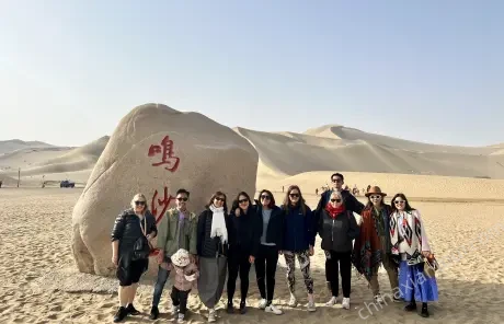
Due to the extreme climate in Taklamakan Desert, most people want to know when is the best time to tour? The golden time is late October to mid-November in autumn. During the period, there are fewer sandstorms and mosquitoes, and the temperature is also mild, making it the best time for a journey across the desert. The most striking scenery is the golden yellow poplar forests along the Tarim Basin, forming a beautiful autumn scenery of the desert.
Spring, summer and winter are not recommended. In recent years, there have been occasional floods flowing into deserts in summer, creating a brief spectacle of “flood in the desert”. But it is rare and summer is extremely hot, so it is not suitable for a trip. In winter, you can see the rare wonder of poplar trees covered with rime ice. But the chilly weather is a great challenge, making it not ideal to have a regular tour. As for spring, the sandstorms and strong winds occur frequently. If you really want to try, self-driving is the best method and make adequate preparations, like enough food and water. Besides, in winter and in spring, pay attention to preventing sandstorms and low temperatures. In summer, be careful to prevent the vehicle from overheating.
Key Desert Highway Stops or Villages
There are a total of four desert roads in the Taklamakan Desert now. Below are the main stops along the road where you can supplement supplies.
Road |
Start and End Points |
Length |
Main Stops and Features |
Luntai – Minfeng Road |
Luntai County – Minfeng County |
566 km |
Lun Tai County – The Tarim River and the poplar forest – Tazong Town – Yatongguzi Village – Minfeng County |
Khotan – Alear Road |
Khotan City – Alear City |
440 km |
Khotan City – Daliyabuyi Village – Hongbai Mountain Service Area – Alear City |
Qiemo – Yuli Road |
Qiemo County – Yuli County |
334 km |
Qiemo County – Tarim River – Luobu Village – Tarim River Special Bridge – Yuli County |
Qiemo – Alear Road |
Qiemo County – Alear City |
525 km |
Qiemo County – Tazhong Town – Alear City |
Plant and Animal of Taklamakan Desert
The Taklamakan Desert is completely different in its flora and fauna.
For plants of the Taklamakan Desert, the majority of the desert is blanketed by moving sand dunes, and it’s hard for plants to exist.
Yet, in the dune troughs, where groundwater is nearer the surface, you might be able to spot some poplars, saltbush, and reeds. Closer to the Taklamakan Desert’s edge, where dunes yield to river valleys and deltas, vegetation rises as a result of groundwater being nearer. Here, not only poplars and reeds but even riverbank specialty vegetation like the Turkish poplar, olive, camel thorn, cotton legumes, and salt-loving vegetation grow.
When it regards animals of the Taklamakan Desert, the landscape is stark and barren. Only on the fringes of the desert, especially in old and new river valleys and deltas, vegetation and water support a variety of animals. Gazelles and wild boars live in these locations, along with predators like wolves and foxes.
In the open desert, though, animal species drop off precipitously. Even the Taklamakan Desert once had tigers, though they’re gone now. Between the dunes, rabbits and sand rats thrive, along with insectivores like long-eared hedgehogs and bats. And among birds, the tiny fluff lark and Tarim jay are the stars, scratching out a existence in this unforgiving land.
Efforts are also being made to create a Taklamakan Desert Green Wall and construct Taklamakan Desert Oasis to further protect this unusual ecosystem.
Taklamakan Desert and the Silk Road
The Taklamakan Desert is at the heart of the Silk Road. It lies on a vital part of the Silk Road, an old path that was initiated with Zhang Qian’s Western Han Dynasty journey to the West.
This made it a main route for trade and cultural exchange between East and West.
Imagine merchants on camel backs crossing the endless dunes of the Taklamakan Desert, carrying silk, tea, and other products to places like Central Asia, the Middle East, and Europe. In return, they brought back treasures like glassware and spices.
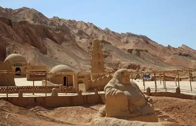
There are Han and Tang ruins, big city ruins, and the famous Niya site in the desert, all testifying to this great history. Besides, the natural environment of the Taklamakan Desert played an important part in Silk Road culture and trade. Postal roads along the two sides of the desert linked with Central Asian, West Asian, and South Asian roads to make up a whole system of the Silk Road. This helped in carrying goods and mixed Eastern and Western civilization.
Because of this, the Taklamakan Desert acted as a bridge between China, Egypt, Babylon, India, and European countries like Greece and Rome. It’s a must-stop for China silk road tour, especially when considering the Silk Road and Taklamakan Desert shared history.
What to See and Visit in Taklamakan Desert
The G216 and G217 highways cut through the heart of the Taklamakan Desert, serving as vital transportation lifelines in this area, and they successfully open up this remote landscape to more travelers. Indeed, the construction of these desert-crossing routes has fulfilled many adventurers and explorers’ expectation, allowing them to experience the vast sand sea up close, offering a rare access to one of the most extreme environments on Earth.
Luntai-Minfeng Desert Highway
It is about 580 kilometers in length, a 9-hour drive. Since there are limited hotels along the way, it is best to reserve a one-day Xinjiang tour. Minfeng County is gaining popularity because of the Qingque Ancient City ruins, where tourists can see precious artifacts from the Niya ruins at the local museum.
Aral Hotan Desert Highway
The highway is 440 kilometers long, and the drive takes approximately 6 hours to complete. Two hours or so after leaving Luntai, you’ll enter the Alar Desert Highway of the Taklamakan Desert, where villages, people, and livestock are scarce, with nothing but endless sands to be company in your Xinjiang travel.
How to Get to Taklamakan Desert
Visiting Rob People Village
- Take a flight (1 hour) or train (4-5.5 hours) from Urumqi to Korla.
- From the downtown of Korla, hire a private car to Rob People Village (80 km, 2-hour driving).
Traveling the Desert Highway (G3012) across Taklamakan Desert:
- Start in Aksu, Kuqa, or Luntai, key Silk Road cities.
- Fly from Urumqi to Kuqa (1 hour) or Aksu (1.5 hours), or take the train to Aksu (9.5-11.5 hours) or Kuqa (7.5-9.5 hours).
- Spend the first night in Aral, then drive through Taklamakan Desertto Hotan via G217 the next day.
- Or fly from Urumqi to Hotan (2 hours) and return by car to Aral.
Taking the Second Desert Highway (G216) through Taklamakan Desert
- Start from Luntai or Mingfeng.
- No direct flights. Train from Urumqi to Luntai (7.5-8 hours) or drive via G3012 through Turpan and Korla.
- Another choice: Drive from Hetian to Mingfeng (290 kilometers, 5.5 hours) via G315, with good scenery through Taklamakan Desert.
Wearing and Packing Tips
Due to the Taklamakan Desert’s extreme climate, which would have scorching heat during the day, freezing temperatures at night, and frequent sandstorms, what you wear and bring is incredibly crucial for this trip.
- Clothing: Wear breathable, long-sleeved shirts and lightweight pants to protect against sunburn and sand. Things like wide-brimmed hat, sunglasses, and scarf or neck gaiter are also necessary for sun and wind protection. If you’re traveling in winter, remember to bring a warm insulated jacket, gloves, and thermal layers.
- Footwear: Sturdy hiking boots or high-top desert shoes are best for walking on hot, shifting sand.
- Gear: Other must-have include sunscreen (SPF 50+), lip balm, a large water bottle or hydration pack, and backup power banks A face mask or dustproof scarf can also help you make it through the sandstorms.
- Camping: If you plan to camp or join a desert trek, it is recommended to bring a four-season sleeping bag, lightweight tent with wind protection, and extra batteries or solar chargers.
FAQs about Taklamakan Desert
How big is the Taklamakan Desert?
The Taklamakan Desert covers about 330,000 square kilometers (127,400 square miles). Its scale makes it China’s largest desert and also the world’s second-largest shifting sand desert.
How much rainfall does the Taklamakan Desert receive annually?
The desert receives extremely low rainfall, the number is typically between 10 and 38 millimeters annually. And its evaporation rates exceed 2,500 mm per year, which makes it one of the driest places on Earth.
Can tourists visit the Taklamakan Desert?
Yes, tourists can visit parts of the desert via guided tours, desert highways, and key access towns like Korla, Luntai, Kuqa, or Hotan. Some routes pass through scenic or cultural spots along the ancient Silk Road.
What is the connection between the Taklamakan Desert and the Silk Road?
The Taklamakan Desert lies along the ancient Silk Road. Back to the time, traders often took routes that skirted its northern and southern edges to transport goods like silk, spices, and jade between China, Central Asia, and the West.
What are some popular activities or attractions for tourists?
Tourists can explore desert highways (like the G217 and G216), visit ruins like the Niya site, ride camels near oasis towns, or take photography tours to capture the vast dunes, Silk Road relics, and even rare winter snowfall.
Is special permit required to visit the Taklamakan Desert?
Yes, and foreigners are explicitly prohibited from entering some areas, especially the core area. To acquire the permit, it is highly recommended to apply through a licensed travel agency. And the process usually takes a long time, so it is necessary to apply at least one month in advance.
Embark on a Xinjiang Adventure with China Xian Tour
Xinjiang is famous for various splendid natural wonders and rich history. The main landscapes in the northern and southern parts of the province are natural scenery and historic sites, respectively. But Xinjiang covers a vast area and the scenic spots are far from each other, so for tourists planning a tour to Xinjiang, a reasonable itinerary is very important. China Xian Tour is pleasant to tailor a trip according to your likes and assign a guide or a driver to escort you during the journey. So do not hesitate to contact us!